Fond de carte
- Titre
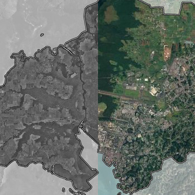
- Photographies aériennes de 1950 à 2021
- Description
- La photographie aérienne correspond à la production d'images photographiques à partir de ballons, hélicoptères ou avions.
L'imagerie "satellite" corresponds à la production d'image à partir des satelitte PLEIADES et SPOT 6 ou 7
Pour aller plus loin dans la comparaison :
https://remonterletemps.ign.fr/comparer/basic?x=-61.532965&y=16.242797&z=16&layer1=ORTHOIMAGERY.ORTHOPHOTOS.1950-1965&layer2=ORTHOIMAGERY.ORTHOPHOTOS&mode=vSlider - Structure
- Cap Excellence
- Courriel
- carto (at) capexcellence.net
- Projection
- EPSG:32620
- Emprise
- 577065.69746157748159021, 1737796.33235660661011934, 767210.95346157473977655, 1838651.66434875689446926